|
|
|||||||||||||
 |
|||||||||
 |
|||||||||
|
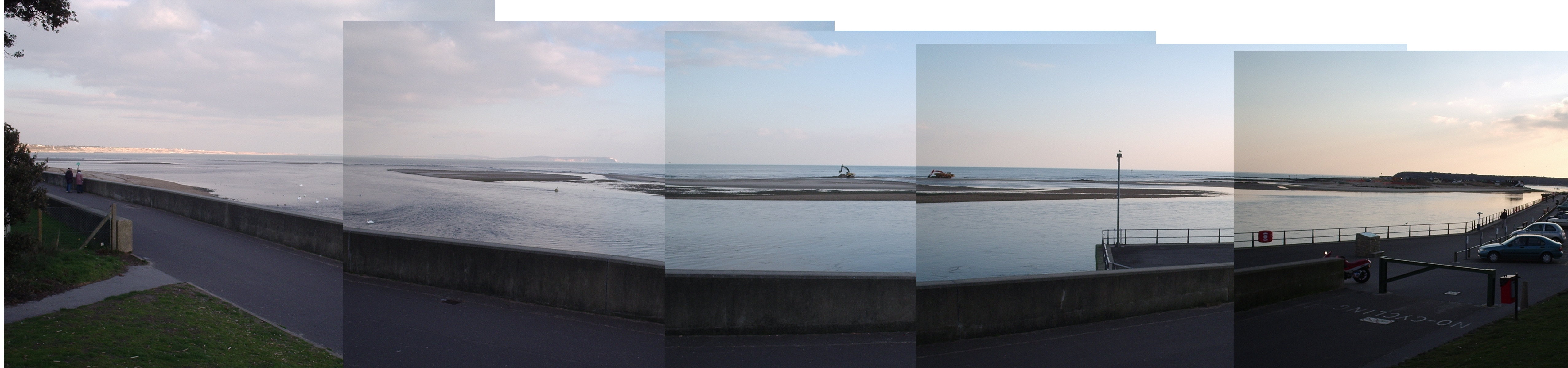
Christchurch Entrance and the outer end of 'the run' LAT Spring 2004(6pm 8 March) from approx N50,43.53 / W1,44.31) - note the council reclaiming beach sand from the spit, see how close the red buoy is to the spit believe it or not, the buoyed channel to the sea goes out directly above the swans in this pic(currently surf and less than 1mdeep) click image above to enlarge (3mb! or download)
|
|||||||||
 |
|||||||||
|
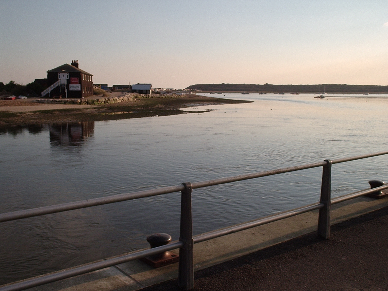
Christchurch Harbour from the SW End of Mudeford Quay (inner end of 'the run') looking 180 degrees right to the NW and the dinghy park end of the harbour (Highcliffe sailing club / council small boat moorings). Taken the same time. position approx N50,43.41 / W1,44,54. Note the LAT exposing the rough ground across the run in front of the black house (this is why you must avoid cutting that corner) sunset at 6pm (8/3/2004), - click on the pic above to enlarge the LHS (700kb) |
|||||||||
 |
|||||||||
|
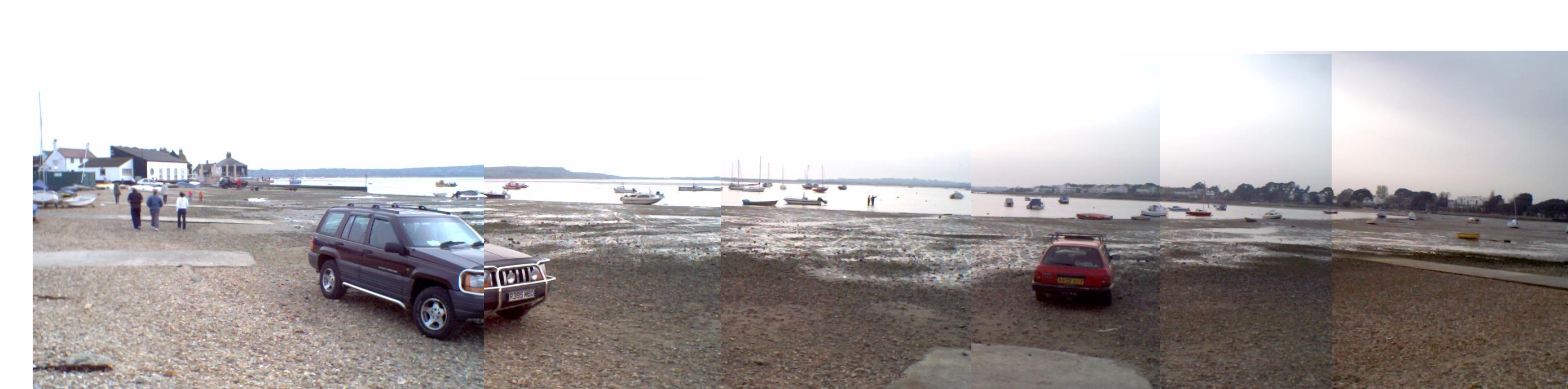
Mudeford Quay - from South to West. Taken at the dinghy park. Summer 2004 low tide springs (approx N50,43.57 / W1,44.49) - click on image to enlarge or download |
|||||||||
 |
|||||||||
|
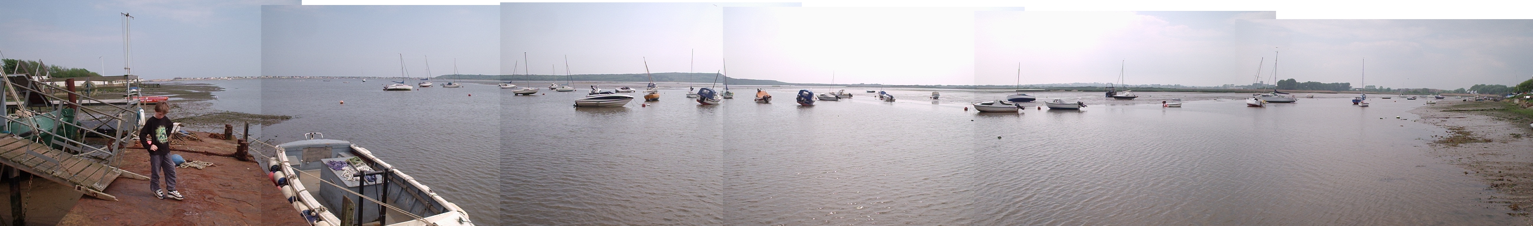
Strides moorings towards Stanpit (right) which are on the North side (Mudeford). Taken from their jetty at low tide springs.My son is on the rusty pontoon, and my yacht is the leftmost with the raised boom leaning over a bit. taken Summer 2004 (N50,43.592 / W1,45.194) - click on image to enlarge or download |
|||||||||
 |
|||||||||
|
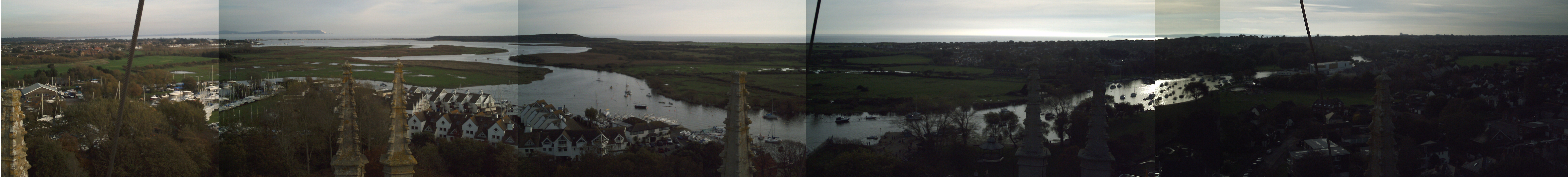
Priory Tower View of the River Stour (RHS) and Avon (LHS) meeting at CSC and going out to harbour via steepbanks and harbour, then sea. Taken November 2006 |
|||||||||
|
[Christchurch Pilot] [Aeriel Photo] [Passages] [GPS Plotting] [OS map] [Panoramas] [Photos] [Yacht Racing] [Links] [GPS 2008] |